3000 New Homes Plan For North West Bicester
A plan to build more than 3000 new homes in North West Bicester is being scoped for its environmental impact by Cherwell District Council.

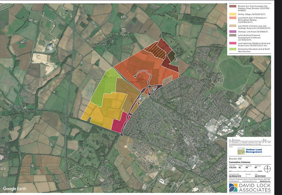
According to planning documents, the proposed site is located on the northern edge of Bicester, some 2.5km to the north west of Bicester Town Centre. To the north is the village of Bucknell and the plan includes Bucknell Road/Bicester Road. The site location is bordered, to the west, by the London to Birmingham Railway, and to the south by the A4095 (Lords Lane). Currently, the predominate uses are agricultural land and farm buildings including those of its surroundings. To the east of the Site lies Elmsbrook, the first phase of the North West Bicester development and to the south is Bure Park.
The development company, Hallam Land Management, has stated that it will be undertaking local community and stakeholder engagement as well as liaison with CDC and other stakeholders, to inform the development proposals.
The plans include Mixed Use Development of up to 3,100 dwellings (including extra care); residential care homes; mixed use local centre, hot food takeaways, public house, wine bar; Learning and Non-residential institutions including primary school, land to allow extension of existing primary school; Green Infrastructure including formal (including playing fields) and informal open space, allotments, landscape, biodiversity and amenity space; burial ground; play space (including Neaps/Leaps/MUGA); changing facilities; large scale photovoltaic system (solar farm); sustainable drainage systems; movement network comprising new highway, cycle and pedestrian routes and access from highway network; car parking; and utility infrastructure.
Within the mixed use area and the employment area, permission is sought for:
• Some 9,000 sq metres of retail commercial and community uses;
• up to 2,490 sq m of commercial uses within retail; food and drink; services, hot food takeaways, public house, wine bar
• up to 3,750 sq m employment uses
• Community uses, nurseries etc
• Residential uses as part of a mixed use scheme
The proposal includes up to 30% affordable housing. The final quantum and mix of affordable housing uses will be agreed in discussion with the Local Planning Authority.
The application proposals make provision for new capacity to delivery primary school education within the application site. Specifically this comprises:
• A new primary school located in the most accessible part of the site;
• Land to allow the expansion of Gagle Brook Primary school located immediately to the east of the application site.
The proposals set out in the outline planning application are envisaged to be delivered over approximately a 12-year period with construction commencing in 2023/24, first completions in 2024 and development completion estimated in around 2035/36.
Details of the Construction phase of the project are not known at this stage, but it has been assumed that the following will occur in accordance with normal development of residential, community and commercial development and the installation of associated infrastructure:
• demolition of existing buildings and structures (little or no demolition is anticipated as a result of the Proposed Development);
• site clearance and preparation;
• groundworks;
• earthworks;
• construction of residential and other buildings;
• installation of underground services, including water supply, sewerage, gas supply,
electric and telecommunication services;
• construction of highway infrastructure and other estate roads; and
• landscaping works to areas of public open space.
You can read the full planning application here:

This isn’t a new proposal, how about instead of spreading fear and unneeded worry to resident you report on the rest of the facts and state that all of this area already has a long history of development potential, not to mention a Cherwell SPD draft.